
Patagonia: What the Region Spans, What It Demands, and What It Gives Back
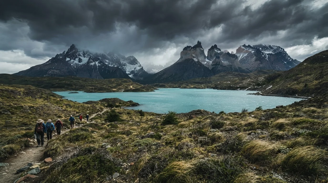
Photo credit: QuickInsights.net
In this article
Stretching across Argentina and Chile, Patagonia is one of Earth's most dramatic landscapes. Here's an honest look at what visiting it actually entails.
Key Takeaways
- Patagonia spans both Argentina and Chile, covering roughly 400,000 square miles of wildly varied terrain.
- The region rewards adventurous, flexible travelers but demands serious preparation for weather and remoteness.
- Infrastructure is thin in many areas - expect long distances between towns and limited services.
- The best time to visit is generally November through March, the Southern Hemisphere summer.
- Iconic sites include Torres del Paine, Los Glaciares, and the Carretera Austral, each with distinct character.
Scenery of genuinely world-class, unmatched scale
The granite spires of Torres del Paine, the Perito Moreno Glacier's 200-foot ice face, and the Fitz Roy massif near El Chaltén represent landscapes with few parallels anywhere on Earth.
Extensive national park protections preserve ecosystems
Large swaths of both Argentine and Chilean Patagonia are protected as national parks or reserves, keeping wildlife corridors and old-growth forests largely intact despite the region's growing tourism profile.
Exceptional trekking infrastructure on major routes
Trails like the W Trek in Torres del Paine are well-maintained and have a network of staffed refugios (mountain huts), making multi-day backcountry experiences accessible without full expedition gear.
Real solitude is still achievable
Despite growing visitor numbers, the sheer size of the region means that travelers willing to go slightly off the main itineraries can find genuine quiet and near-empty landscapes.
Rich and varied wildlife encounters
Patagonia hosts guanacos, Andean condors, Magellanic penguins, southern right whales, and - with luck - pumas, in largely undisturbed habitat.
Weather is unpredictable and frequently severe
Wind speeds routinely exceed 60 mph in exposed areas, and conditions can shift from sun to sleet within an hour. Itinerary flexibility is not optional - it's a survival skill.
Vast distances complicate multi-site itineraries
Getting from Argentine Patagonia to Chilean Patagonia involves long bus journeys or expensive short-haul flights with limited schedules. Underestimating transit time is the most common trip-planning mistake.
High costs relative to broader South America travel
Park entry fees, flights into gateway airports, accommodation during peak season, and guide services in remote areas all carry a significant price premium compared with other regional destinations.
Limited services and medical infrastructure in remote zones
Towns are widely spaced, cell coverage is sparse, and medical facilities are minimal outside larger cities. Travelers with health conditions or those undertaking serious treks should plan accordingly and consult a travel medicine professional.
Peak-season reservations require months of advance planning
Huts and campsites on the W Trek and O Circuit in Torres del Paine can sell out six months or more in advance during the December-February peak window.
What Patagonia Actually Is - and How Big
Patagonia is not a country or a single park. It's a geographic region shared by Argentina and Chile, stretching from roughly the 40th parallel south to the tip of the continent at Cape Horn. That covers an area larger than Texas and California combined - glaciers, steppe, temperate rainforest, fjords, and volcanic peaks all within the same regional label.
On the Argentine side, the landscape is dominated by wide-open Patagonian steppe and the Andes foothills. Cities like Bariloche and El Calafate serve as gateways. The Chilean side is wetter, more rugged, and more fragmented - a maze of channels, islands, and fjords. The famous Carretera Austral, a partially unpaved highway stretching over 700 miles through Chilean Patagonia, is itself a destination.
Understanding this scale matters before you book anything. Travelers who expect to see both Torres del Paine and the Perito Moreno Glacier in a single quick trip often underestimate the travel time between them - overland crossings and limited flights can add days to even a simple itinerary.
If you're drawn to the kind of region-by-region planning this demands, New Zealand's South Island offers a useful comparison - another vast, varied landmass where orientation upfront saves real frustration later.
The Pros: Why Patagonia Is Worth the Effort
For travelers willing to do the legwork, the rewards are difficult to overstate.
Scenery of genuinely world-class, unmatched scale
The granite spires of Torres del Paine, the Perito Moreno Glacier's 200-foot ice face, and the Fitz Roy massif near El Chaltén represent landscapes with few parallels anywhere on Earth.
Extensive national park protections preserve ecosystems
Large swaths of both Argentine and Chilean Patagonia are protected as national parks or reserves, keeping wildlife corridors and old-growth forests largely intact despite the region's growing tourism profile.
Exceptional trekking infrastructure on major routes
Trails like the W Trek in Torres del Paine are well-maintained and have a network of staffed refugios (mountain huts), making multi-day backcountry experiences accessible without full expedition gear.
Real solitude is still achievable
Despite growing visitor numbers, the sheer size of the region means that travelers willing to go slightly off the main itineraries can find genuine quiet and near-empty landscapes.
Rich and varied wildlife encounters
Patagonia hosts guanacos, Andean condors, Magellanic penguins, southern right whales, and - with luck - pumas, in largely undisturbed habitat.
~400,000
Square miles in the Patagonia region
Patagonia spans roughly 400,000 square miles across Argentina and Chile, larger than most countries in Europe.
700+ miles
Length of the Carretera Austral highway
Chile's Carretera Austral runs more than 700 miles through some of the most remote terrain in South America, with significant unpaved sections.
The wildlife and ecological diversity compound those visual rewards. Penguins, condors, guanacos, and pumas share landscapes with ancient lenga beech forests and millennia-old glaciers. Because much of the region is protected as national park land on both sides of the border, the ecosystems remain largely intact.
There's also a quality of solitude that's increasingly rare. Even at popular trailheads, the sheer size of the terrain disperses crowds. Step a day off the main trekking routes and you may see no one.
The Cons: What Patagonia Actually Demands
Patagonia's reputation for difficulty is not exaggerated - it's earned.
Weather is unpredictable and frequently severe
Wind speeds routinely exceed 60 mph in exposed areas, and conditions can shift from sun to sleet within an hour. Itinerary flexibility is not optional - it's a survival skill.
Vast distances complicate multi-site itineraries
Getting from Argentine Patagonia to Chilean Patagonia involves long bus journeys or expensive short-haul flights with limited schedules. Underestimating transit time is the most common trip-planning mistake.
High costs relative to broader South America travel
Park entry fees, flights into gateway airports, accommodation during peak season, and guide services in remote areas all carry a significant price premium compared with other regional destinations.
Limited services and medical infrastructure in remote zones
Towns are widely spaced, cell coverage is sparse, and medical facilities are minimal outside larger cities. Travelers with health conditions or those undertaking serious treks should plan accordingly and consult a travel medicine professional.
Peak-season reservations require months of advance planning
Huts and campsites on the W Trek and O Circuit in Torres del Paine can sell out six months or more in advance during the December-February peak window.
Travel Health and Safety Preparation
Remote Patagonian trekking puts you far from emergency medical services. Before any serious backcountry trip, consult a travel medicine professional about vaccinations and altitude or cold-weather considerations. Comprehensive travel insurance that includes emergency evacuation coverage is strongly advisable - verify exactly what your policy covers before you depart.
Costs also add up quickly. Flights into gateway airports like Punta Arenas or El Calafate are often expensive, and park fees, gear rental, and guided services in remote areas carry a premium. Budget travelers can manage, but it requires careful planning rather than improvisation.
Planning Frameworks Worth Knowing
Most travelers focus on one of three zones: the Torres del Paine corridor in Chilean Patagonia, the Los Glaciares National Park zone on the Argentine side (home to El Calafate and El Chaltén), or the Carretera Austral for road-trippers and cyclists. Each has a distinct character and different infrastructure demands.
The W Trek and O Circuit in Torres del Paine require advance hut or campsite reservations - often months ahead during peak season (December through February). El Chaltén, a small trekking village, offers free day hikes with no permits required, making it an accessible entry point for those newer to the region.
Seasonality matters more here than in most destinations. November and March offer shoulder-season conditions - fewer crowds, still-reasonable weather - while January is peak summer but also peak wind. Winter travel (June through August) is possible in some areas but cuts access to many trails and services.
Always verify current entry requirements, park reservation systems, and any travel advisories through official Argentine and Chilean government sources before finalizing plans. Conditions and policies change.

Author
Travel Editorial Team
Travel Editorial Team is the collective byline for our editorial team and contributor network. Articles published under this byline or an editorial pen name are researched, written, and reviewed according to our editorial standards for clarity, consistency, and independence before publication.
View all articles →